Friday 26 April 2013

Raise & White Side

Raise & White Side 26-04-2013

This map was created using GPS Visualizer's do-it-yourself geographic utilities.

Please wait while the map data loads...


Route: Stanah, Stanah Gill, Sticks Pass, Raise, White Side, Brown Crag, Fisher Place, Stybeck Farm

Date: 26/04/2013
From: Stanah


Parking: Small Car Park at Stanah (honesty box)
Start Point: Stanah
Region: Eastern Fells

Route length: 6.7miles (10.8km)
Time taken: 3:46
Average speed: 1.8mph
Ascent: 874m
Descent: 877m

Wainwrights on this walk:
Raise (883m), White Side (863m)

Additional summits: Brown Crag (610m)

Other points of interest: Sticks Pass

One of the first rules of fell walking is generally 'be prepared for anything' and this walk went to prove that. The final walk we had planned during a week-long break, this should have been one of the best but ended up being a bit of a disappointment, as you'll see later. The plan was to follow a linear route from Stanah that crossed the whole Helvellyn range to Seat Sandal and into Grasmere where we were staying. Unfortunately, the weather conspired against us at the crucial moment.

The day started in fine sunshine and I was really looking forward to the walk we had planned. Using two cars, we left one in a layby at the Travellers Rest pub to use as a shuttle for when we finished at the end. The other took us to the starting point, a small car park at a community centre in Stanah, just off the A591. The forecast suggested the possibility of showers so we packed accordingly, all taking a full set of waterproofs, just in case. This would turn out to be a wise move.
The path starts by crossing a ladder stile
Leaving Stanah, we made our way up a path that leads to Sty Beck Fall, crossing the stream and climbing up the very steep path towards Sticks Pass. Such a steep incline at the very start of the walk was a bit of a shock to the system but we ploughed on, knowing the very steep section constituted only a quarter of the climb.
Crossing Stanah Gill
The path towards Sticks Pass was very steep to start with
There are some excellent views along the valley towards Blencathra and Skiddaw and it was about halfway up the ascent we saw the clouds start rolling in from the west. We resisted donning the waterproofs in a vain attempt to convince whoever was in charge of the weather that we wouldn't need them. It didn't work.
The view along the valley towards the northern fells
The path became less steep as it climbs
The clouds start to look a bit ominous
The rain gathers in the distance....
.... and heads in our direction
Not long after first spotting the clouds, it was apparent that they were not going to drift idly on by but were, in fact, heading straight in our direction, throwing down some very heavy looking rain. We could wait no more and the waterproof jackets went on. And this is where the surprise came.
What is that falling from the sky?
Reaching Sticks Pass, the clouds caught up with us bringing not rain, but hail and snow. And a very strong, gusty wind. In no time at all, a fine, bright sunny day had turned into a drab, windy, cold one. A simple lesson here is that the weather in the Lakes can turn in an instant and no matter how good a forecast is, to always be prepared for the worst. Climbing Raise kept off most of the cold, that was until we paused at the summit. At 856m, Raise is a very large mountain but seems small in comparison to some of the giants it shares along the range. Not wanting to hang around, we headed for White Side.
The path from Sticks Pass is easy to follow
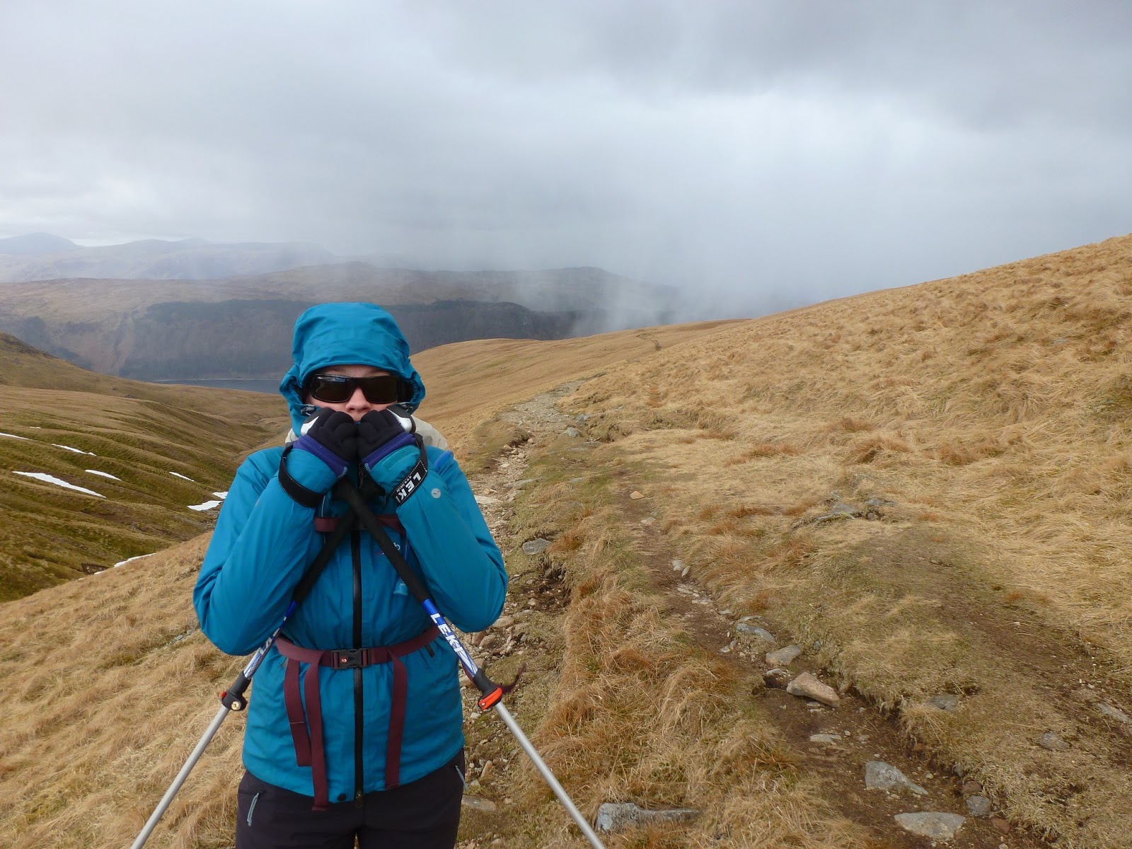
Sara gets a fine coating of wind-driven sleet
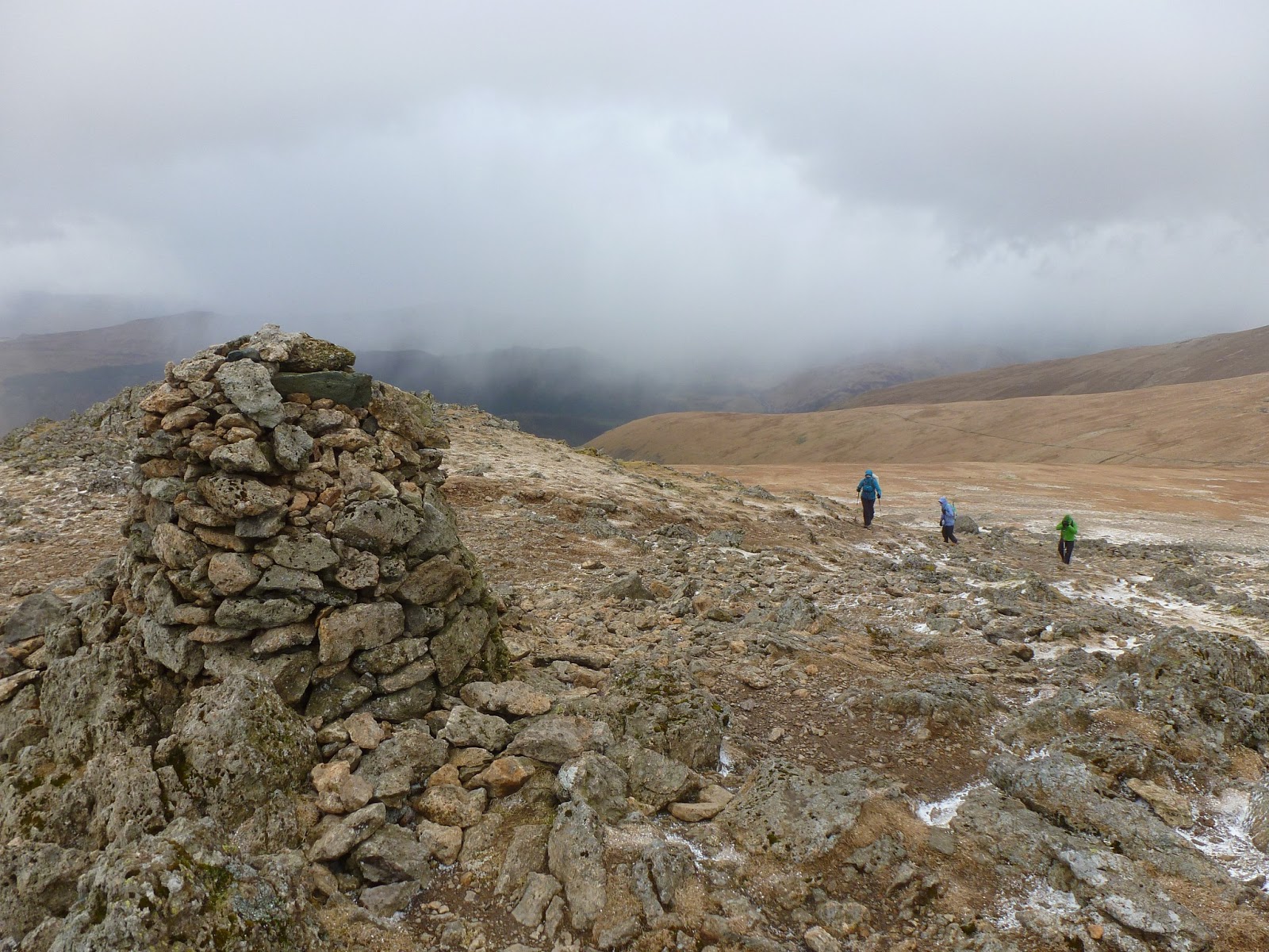
The snow subsided briefly as we reached the summit of Raise
'That way'
The cloud and wind subsided briefly as we passed between Raise and White Side, enough to stop and have lunch in a rather tumbledown shelter on the summit of White Side. Strictly speaking, the summit has no name but is referred to as White Side thanks to the name of the western slope. We were hoping to stay for long enough for the wind to die down a bit and, as it did momentarily, we started across towards Helvellyn.
The path leading to the summit of White Side
The wind was pretty strong on the way to White Side
A pause for lunch on White Side, still wrapped up against the elements
Dropping off White Side, our hopes lifted slightly with the clouds, exposing a wonderfully imposing view of Catstye Cam, Swirral Edge and Helvellyn. The summit, however, was still shrouded in cloud. As we made our way towards the ridge up onto Lower Man we passed a group who had turned back, suggesting it was too windy on the ridge. We took their advice on board and cautiously made our way onto the ridge.
Catstye Cam, Helvellyn and Lower Man
The weather worsens as we reach the ridge up to Lower Man
As we started to climb the ridge, the weather deteriorated once again, the cloud dropping lower and the wind picking up and becoming very strong. We slowly made our way up, stopping around halfway behind the shelter of some rocks to decide our next move. Having never climbed this path before and not knowing what to expect along the narrow ridge, we decided the safest thing to do was turn around and head back. Helvellyn would have to wait for another day.
The weather on the ridge was very poor
Following the path back, we took the first path that would lead us back to the at Stanah. The path is about halfway between the ridge and White Side and is marked by a cairn. As we reached it, the clouds lifted a bit to reveal Helvellyn and Catstye Cam once again. We followed the right of way around the area of the map actually called White Side until we reached Brown Crag.
Catstye Cam and Helvellyn appear from the cloud
The weather looks a bit more sedate underneath Browncove Crags
Crossing Brown Crag, we descended further until we reached Fisherplace Gill and a well-made path that took us along the drystone wall back towards Stanah.
Sara follows the drystone wall towards Fisherplace Gill 
Fisherplace Gill tumbles down the mountainside
It was particularly disappointing not being able to complete this walk as I had been looking forward to it all week. That said though, safety is paramount and we certainly made the right decision. There's every chance that had we continued we may have got into some serious difficulty, which is best avoided. 'The mountains aren't going anywhere'. We'll be back to try this one again, that's for sure.

1 comment :

  1. Have you got a GPX file for this route please?

    ReplyDelete