
This map was created using GPS Visualizer's do-it-yourself geographic utilities.
Please wait while the map data loads...
From: Hardraw
Parking: Roadside parking just outside Hardraw
Start Point: Hardraw village
Region: Yorkshire Dales
Route length: 11.8miles (19km)
Time taken: 04:18
Average speed: 2.7mph
Ascent: 800m
Descent: 805m
2000s on this walk:
Great Shunner Fell (716m), Lovely Seat (675m)
Additional summits: Little Shunner Fell (653m)
Other points of interest: The Buttertubs, Shaw Gill Wood
Great Shunner Fell and Lovely Seat separate the valleys of Wensleydale and Swaledale in the northern Yorkshire Dales. In their entirety, both fells cut an enormous swathe across the landscape, bridging the boundaries of the National Park between Castle Bolton in the east and Mallerstang in the west. Such is their enormity that a number of their descending ridges go on to form additional summits; most notably the Mallerstang ridge that includes a number of prominent peaks.
After a mid-week walk around Beamsley, I was getting itchy feet for a good day out in the Dales and the first weekend of spring seemed perfect. I had gazed upon the moorland of Great Shunner Fell and Lovely Seat from the lofty vantage point of Drumaldrace, across the valley, and decided a few months ago that they would be the next two fells on the list of Yorkshire 2,000ft-ers that I'd be tackling.
After getting a very early start (and I mean very), I arrived at Hardraw at 0730. I had originally intended to do this walk from Hawes but a last-minute Google assisted search had identified a substantial area to leave the car right at the foot of the Pennine Way. Not only would this cut a couple of miles off the route (which was handy as I was a bit pushed for time), it would also mean that I would be starting right at the southern toe of Great Shunner Fell.
 |
| This way to begin |
 |
| The walk starts along a wide track through Hardraw |
 |
| The track leads towards the distant Great Shunner fell |
 |
| High Clint, part of Lovely Seat. You'll see the two cairns on the skyline later |
 |
| Wensleydale with Ten End and Drumaldrace in the distance |
 |
| The distant Addlebrough over the Pennine Way |
 |
| Keep following the signs |
 |
| Hearne Top from Little Fell |
 |
| The path continues over Hearne Top |
 |
| The first of several sections of flagstoned path |
 |
| A handy boulder-cum-cairn |
 |
| The path crossing Black Hill Moss |
 |
| Crag Hill Beacon looking back to Black Hill Moss |
 |
| Peat hags at Hearne Edge |
 |
| Into the cloud as I reached Hearne Head |
 |
| Hearne Head, the beginnings of Hearne Beck |
 |
| The summit shelter appears out of the murk |
 |
| The summit cross shelter |
 |
| Self-timer inspired photo |
 |
| The hidden trig pillar |
 |
| The handy fence leads the way |
 |
| Little Shunner Fell in the distance |
 |
| The summit of Little Shunner Fell is marked by a cairn |
 |
| Hood Rigg |
 |
| The slopes of Lovely Seat |
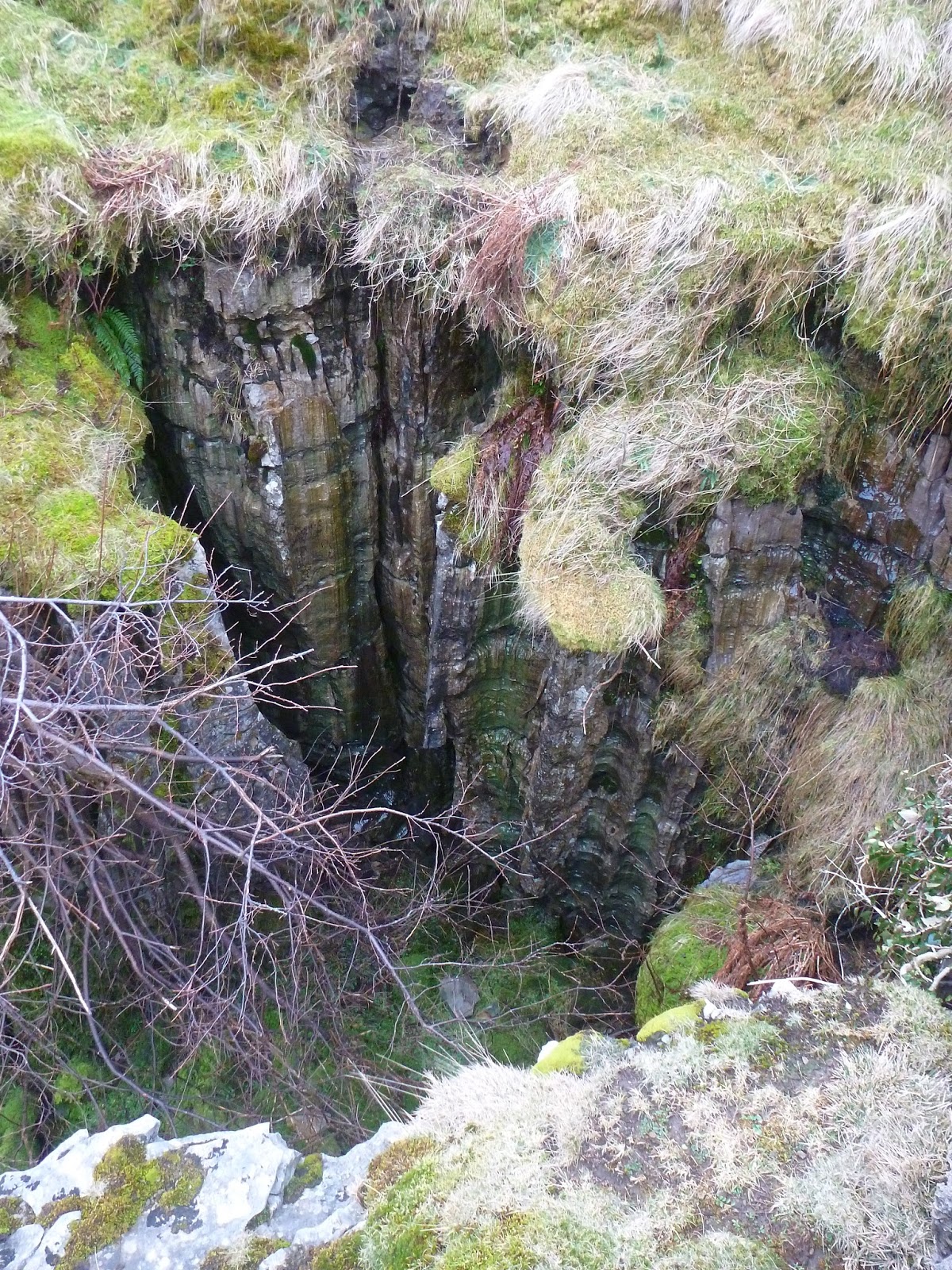
The Buttertubs stand near the highest point of the pass between Hawes and Thwaite, a pass that also bears their name. It's a popular pass with cyclists, hence a vast amount of information on the web is actually more relevant to the lycra-clad men and women of the cycling fraternity rather than the actual geology that lends its name to the location. It may be even harder to find information about the landscape once the King of the Mountain stage of the Tour de France passes over in the summer and everyone wants to re-create their own little moment of history, probably without the multi-million-pound support crews though. And the drugs.
In short, the Buttertubs are a number of large limestone potholes, measuring some 20m deep in places. They are similar in formation to the classic clints and grykes found on areas of limestone pavements, however, in this instance, the erosive force of the water has burrowed down the cracks to such an extent that it has created a series of vertical limestone stacks, surrounded by deep holes and excavations. Why the buttertubs though? The most popular theory is that local farmers from Swaledale, on their way to and from Hawes, used the potholes as a convenient fridge to save them the effort of numerous trips over the pass carrying their dairy produce, probably (as the name suggests) tubs of butter. The Buttertubs are part of the Cliff Force Cave SSSI.
 |
| The Buttertubs |
 |
| The Buttertubs |
 |
| The Buttertubs |
 |
| A seemingly long way down |
 |
| The Buttertubs |
 |
| The Buttertubs |
 |
| Bull Bogs |
 |
| The fence leading to the summit |
 |
| The summit of Lovely Seat |
 |
| Lovely Seat's lovely seat |
 |
| A suitable throne |
 |
| There is no path off the summit of Lovely Seat |
 |
| Still following a bearing |
 |
| Low Millstones |
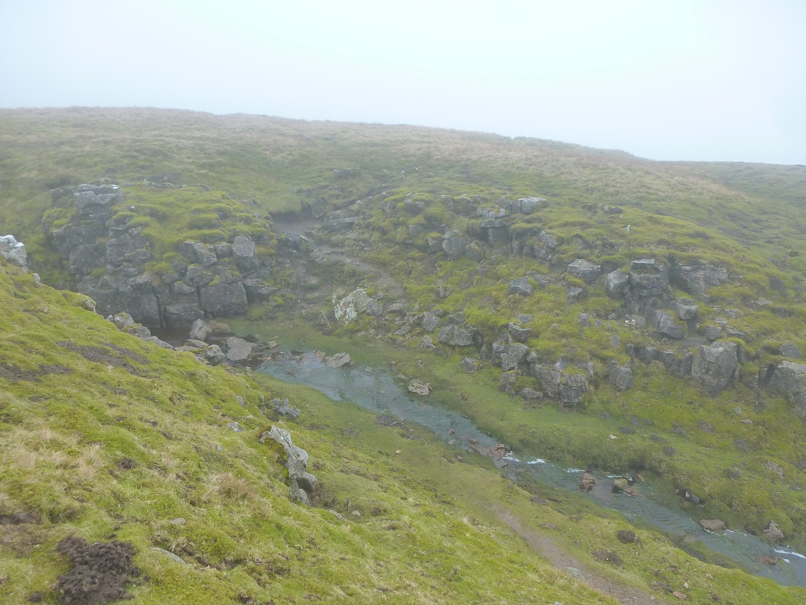 |
| Shivery Gill |
 |
| Shivery Gill is usually dry in the summer months |
 |
| Shivery Gill |
 |
| A pair of cairns atop Pike Hill - mentioned earlier |
 |
| Emerging from the cloud |
 |
| Great Shunner Fell |
 |
| Some classic Yorkshire Dales scenery |
 |
| Shaw Gill Wood |
 |
| Shaw Gill Wood |
 |
| Shaw Gill |
 |
| A pheasant guarding the walled lane back to the road |
 |
| The village of Hardraw |
 |
| Hardraw Beck after its exciting journey over Hardraw Force |
No comments :
Post a Comment