Cracoe Fell & Burnsall and Thorpe Fell 13-04-2013
This map was created using GPS Visualizer's do-it-yourself geographic utilities.
Please wait while the map data loads...
Route: Rylstone, Bark Brow, Sun Moor Hill, High Bark, Rylstone Cross, Watt Crag (War Memorial), Peter's Crag, Vartle Crag, Rolling Gate Nook, Burnsall & Thorpe Fell, Hesker Gill, Thorpe, Elbolton Hill, Far Langerton, Thorpe Lane, Cracoe, Chapel Lane. Rylstone
Date: 13/04/2014
From: Rylstone
Parking: Layby in Rylstone
Start Point: Rylstone village
Region: Yorkshire Dales
Route length: 10.2 miles (16.4km)
Time taken: 04:00
Average speed: 2.5mph
Ascent: 533m
Descent: 548m
Summits: Burnsall and Thorpe Fell (506m)
Other points of interest: Rylstone Cross, Cracoe War Memorial, Elbolton Hill
A large expanse of moorland rises up to over 500m a short distance north of the market town of Skipton, an area of sufficient size to contain two large reservoirs; Upper and Lower Barden reservoirs. The land separates Wharfedale and Airedale, two of the principal valleys in this area of Yorkshire.
This area of Moorland, the combination of Cracoe Fell and Burnsall & Thorpe Fell has long been on the list of 'things that I'd like to climb' and the impressive hilltop monuments have been beckoned every time we've passed by, bound for other places. And so it was that Sara and I found ourselves dressed and ready to tackle it on a blustery day early in the spring. The one thing that had drawn me so magnetically to this desolate area are the two immense monuments that are perched overlooking the valley; a large cross and an equally sizeable stone obelisk.
We abandoned the car in the village of Rylstone in a layby at the end of the delightfully named Mucky Lane before making our way swiftly past the old church and out into the fields at the foot of Rylstone Fell. The village of Rylstone is famous for its more active members of the Women's Institute who, in 1998 after cancer claimed one of their husband's life's, decided to pose for a nude calendar to raise money for the unit where he was treated. The calendar was an unrivalled success and the Calendar Girls, as they became known, have gone on to raise over £3 million for Leukaemia & Lymphoma Research.
 |
| St. Peter's church on our climb out of the village |
 |
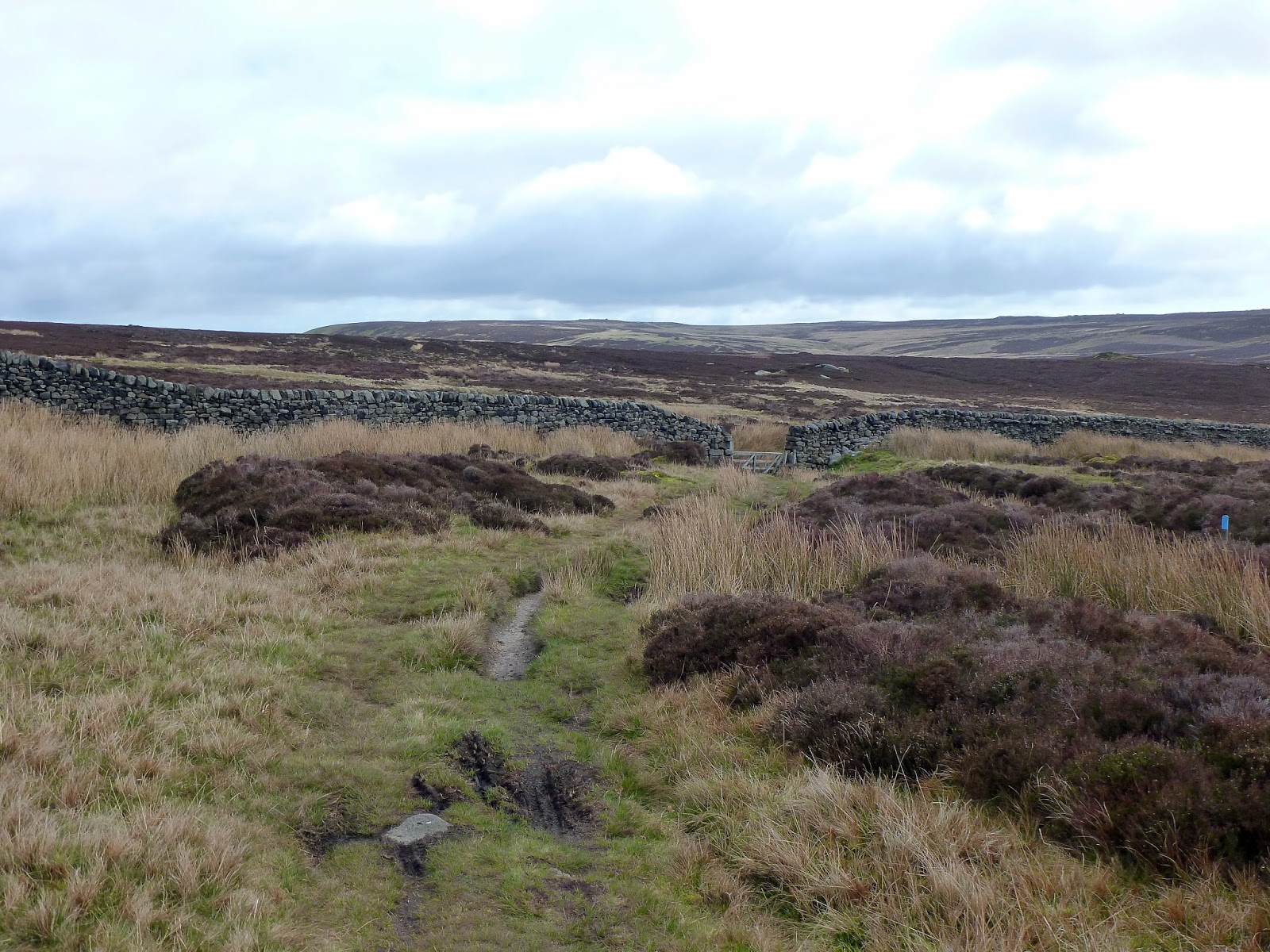
| The wide track leads towards Rylstone Moor |
A stony track leads up the side of Rylstone Moor past the distant remains on Norton Tower, 16th Century hunting lodge, and onwards to High Bark where you meet a large drystone wall. The path makes a sharp turn before it climbs the final few meters up to the Rylstone Cross.
 |
| Cracoe Fell under a moody sky |
 |
| Our first good view of the Rylstone Cross |
 |
| The cross sits on a rock outcrop |
 |
| The path leads up Sun Moor Hill |
 |
| The bleak Embsay Moor |
 |
| The path along High Bark leads directly to the cross |
 |
| The proud Rylstone Cross |
The cross looks large from afar and up close it really is immense. The cross stands on a rocky escarpment of Barden Moor, where it overlooks Rylstone. Originally a large stone cairn stood here that was known as “The Stone Man” but a wooden cross was later erected to commemorate “The Peace of Paris”, a set of treaties that ended the American Revolutionary War. The cross was dated 1885 and bore the carved initials DD and TB to signify the Duke of Devonshire and T. Broughton, who was land agent to the Duke. The cross has been renewed several times since then and the present cross has been in situ since 1995.
 |
| The cross with me for scale |
 |
| A close-up of the cross |
 |
| The view out over the Yorkshire Dales |
 |
| Reminiscent of Stanage - the view along the ridge |
We spent a good few minutes poking around the cross, all then while being buffeted by the strong breeze. In addition to being impressive in its own right, the cross has a wonderful view across the Yorkshire Dales as well as an exciting view of the nearby war memorial, which was to be our next destination.
 |
| Climbing along the ridge |
 |
| A boundary stone at Potter Gap |
The path climbs on, gaining another 100m of elevation as it follows the wall northwards before it reaches the aforementioned memorial - an immense obelisk dedicated to the men of the area who lost their lives in the Great War. We arrived just behind a much larger party so, while they milled around the base of the monument, Sara and I sought shelter off the path amongst the stones for a quick lunch stop. This allowed the larger group enough time to lose interest and potter onwards leaving us alone to savour both the memorial and the views across Yorkshire.
 |
| The rocks in which we chose to shelter for lunch |
 |
| The war memorial |
 |
| The plaque and some very old initials |
 |
| Sara for scale this time |
 |
| The memorial through a depression in the drystone wall |
The day was still young and there was a trig pillar to visit so we continued north, following the familiar drystone wall to a track intended to ferry grouse hunters up onto the moorside. The track, following the contour of the fell, turns east where it passes closest to the marked high point of the entire moorland; Thorpe Fell Top. It was too much to resist so, leaving Sara behind, I ploughed upwards through the heather to the lonely pillar.
 |
| The drystone wall looking back to the war memorial |
 |
| Approaching the trig pillar on Thorpe Fell |
Despite being the marked high point on the maps, there is some suggestion that the rocky base of the war memorial may sit as much as 4m higher. It would be a more fitting summit and certainly would receive many more visitors. I do like this pillar though, sat in splendid isolation high above the moors, and imagine that it is rarely frequented, despite it standing close to some of the more popular spots in the Dales.
 |
| A rather sad-looking pillar |
 |
| Summit self-portrait |
At this point, having returned to Sara, time had come to end our acquaintance with the top of the moor and get a bit more up close and personal to the valley below. From the shooting track, a vague path heads north, down the fell side to the west of Hesker Gill, which becomes more and more dramatic as you descend. This location also provides a sweeping view right down the Wharfe valley to Appletreewick and beyond. The path reaches a walled lane which drops down into the tiny village of Thorpe, a place Sara and I have passed through a number of times while on a different route, usually bound for Burnsall. This time though, we'd be heading the opposite direction, towards the mysterious Elbolton Hill.
 |
| Wharfedale from Thorpe Fell |
 |
| A young Hesker Gill |
 |
| The village of Burnsall |
 |
| The walled lane leading to Thorpe |
 |
| Elbolton Hill |
Known as the "Hill of the Fairies", Elbolton is one of several interesting and supposedly supernatural places lying within the so-called "Barden Triangle", an area around the head of Lower Wharfedale which includes supposedly supernatural associations such as the reputedly haunted limestone gorge of Troller's Gill and the Dibble's Bridge.
In addition to this, Elbolton Hill is a sacred hill that is dotted with caves that contained the remains of skeletons and pottery. Dating back to the Neolithic and Bronze Age periods, the finds here support the theory that this was a burial site rather than the local hang out for fairies.
Back to modern times though, Elbolton Hill is one of several small, steep-sided hills that form the Cracoe Reef Knolls. They are the geological remnants of an ancient coral reef that formed in a shallow prehistoric sea many millions of years ago, much the same as Chrome Hill and Parkhouse Hill in the Peak District. The Cracoe Reef Knolls include Kail, Elbolton, Stebden, Skelterton and Butter Haw hills and we'd be passing by most of them on our return to Rylstone.
 |
| The steep slopes of Elbolton Hill |
 |
| Stebden Hill |
After getting mildly lost on our way through some fields, we reached Thorpe Lane, ready for a long walk back to Cracoe. The weather had cheered up remarkably by now and the sight of ranks of daffodils confirmed that spring was well and truly on the way. We weren't far from reaching the car but still had time to rescue a duckling from a cattle grid, stroll down a quiet lane and re-visit St. Peter's church that we'd seen earlier.
 |
| Butter Haw Hill |
 |
| Spring is in the air along Thorpe Lane |
 |
| Thorpe Lane |
 |
| The village of Cracoe |
 |
| Sara heads along Church Lane |
 |
| The impressive ridge of Cracoe Fell |
And so there it is, curiosity satisfied. This is a great day out, and we saw very few people, even the long stroll along Thorpe Lane was quiet of both people and traffic. It was great to finally get an up-close view of the monuments that have gazed down on us every time we've passed through. Having just scratched the surface, I'd very much like to investigate Barden Moor further; there's plenty of it to go around.


Looking to do the War memorial for Remembrance Sunday do you have a GPX or route I can use at all ?
ReplyDelete