Sunday 8 February 2015

Bowfell, Esk Pike, Allen Crags & Rossett Pike

Bowfell, Esk Pike, Allen Crags & Rossett Pike 08-02-2015

This map was created using GPS Visualizer's do-it-yourself geographic utilities.

Please wait while the map data loads...


Route: Stool End, The Band, Earing Crag, Three Tarns, Bowfell, Bowfell North Top, Ore Gap, Pike de Bield, Esk Pike, Esk Hause, Allen Crags, Angle Tarn, Rossett Pike, Buck Pike, Black Crags, Stake Pass, Langdale Combe, Stake Gill, Mickleden, Middle Fell Farm

Date: 08/02/2015
From: Great Langdale NT Campsite


Parking: Langdale NT Campsite
Start Point: Langdale NT Campsite
Region: Southern / Central Fells

Route length: 12.3 miles (19.7 km)
Time taken: 05:58
Average speed: 2.06 mph
Ascent: 1231m
Descent: 1234m

Wainwrights on this walk:
Bowfell (902m), Esk Pike (885m), Allen Crags (785m), Rossett Pike (651m)

Additional summits: Bowfell North Top (866m), Pike de Bield (810m), Buck Pike (606m), Black Crags (588m)

Other points of interest: Esk Hause, Langdale Combe

I had promised myself this winter to try and get up Bowfell and admire the expansive views from its summit, which are amongst the best in the Lake District. I had thought about it while I was up for a few days in January but the weather was particularly challenging making any attempt to see the views futile. Instead, I had another window of opportunity during February which I managed to grasp with both hands and what a day it turned out to be.

I've been up Bowfell a few times and it's definitely one of the finest mountains in the Lake District with unsurpassed views in all directions. It's also a mountain that has a few routes that present little in the way of technical or steep ground which is why I chose it for my early forays into winter fell walking.

I awoke inside a frosty tent early on Sunday morning, greeted by a surprisingly brilliant and blue sky. Not quite what was forecast but a glance at the most up-to-date information from MWIS suggested that if I got a move on, I'd have a morning clear of clouds to get up the Bowfell. You'll see from the photos that it really was clear, a perfect day to be up on the fells.
A lonely tent beneath Raven Crag
Sun shines on Mickleden and Bowfell
My chosen route was up along The Band, a popular ridge that rises from Stool End farm to Three Tarns, a stone's throw from Bowfell's summit. It's perhaps the least interesting route up Bowfell but it certainly provides an easy ascent, especially for novice winter walkers like myself. It's all valuable experience in the early days of winter walking.
The Band with Crinkle Crags beyond
No mistaking the route through Stool End farm
Some of the Langdale Pikes - Pike O'Stickle and Loft Crag to be precise
So, The Band. A much-maligned but straightforward route up to one of the finest peaks in the country, a route that I've done on previous occasions. I don't actually think it's that bad, a little tedious at times but certainly no hardship. It did, however, seem to take a long time to reach White Stones, an intermediate peak about halfway along. I did consider climbing it but a quick glance behind confirmed the clouds were indeed starting to slowly roll in so I White Stones will be revisited another time. For now, I had my sights set on Three Tarns and arriving before the clouds did.
A misty Great Langdale from the foot of The Band
The only way is up
Pike O'Stickle in detail
Looking down The Band into Great Langdale
Great Knott
Great Langdale
The Langdale Pikes and Great Langdale
Did I mention it was a stunning morning? The light on Crinkle Crags was fantastic and The Band provides a perfect viewing platform to inspect them. The final section of The Band is laid out ahead of you as you cross Earing Crag and the snow began to get considerably thicker. Up until this point, the worst parts had been easy to bypass or avoid and the consequences of a slip or fall on The Band would just be embarrassment rather than a significant injury. I decided to keep the crampons in the bag, for now, mainly to save a bit of time and get to Three Tarns. Once again, I glanced towards Great Langdale and noticed the clouds rolling diligently in, though much lower than I've ever seen them. Low enough to fill the valleys below and begin to create a spectacle I've always wanted to see. A full cloud inversion.
Crinkle Crags
Light streams by Pike O'Blisco
Reaching Earing Crag on The Band
Crinkle Crags in detail
Bowfell
The  most extensive patch of snow on The Band
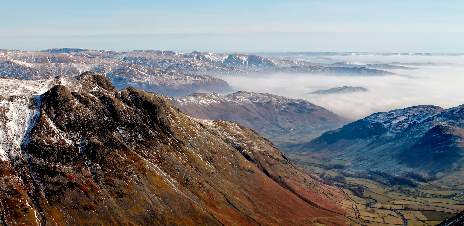
An inversion approaches......
The final climb up to Three Tarns
How unexpectedly brilliant. In addition to this, I had just reached Three Tarns and had my first view of the magnificent snow-dusted Scafells. They really do look imposing from here, especially with the cloud swirling around their base. Looking up at the final steep climb up Bowfell I decided to take the plunge and put the crampons on, a first for me.
Scafell and Scafell Pike
Slight Side and the enormous Cam Spout Crag
Inversion in Eskdale
Bowfell's famous Links
Three Tarns
Proof that the spikes really did go on
I plodded up the mountainside, going over the wise words from our instructors at Plas y Brenin in my head. Rule number one - don't fall over. In all honesty, I found walking in the crampons no different to wearing normal boots - I do think that I have quite a wide-footed stance which does help a lot. I fact, I thoroughly enjoyed having the metalwork on my feet as it makes every foot placement confident and secure. A real confidence booster.
The rump of Crinkle Crags
Approaching the summit of Bowfell
Glaramara with Skiddaw in the distance
Eventually, and a surprisingly short time after leaving Great Langdale, I arrived on Bowfell's magnificent summit which I had all to myself. Bowfell has some of the best views in the whole National Park thanks to its isolation and position among the Lakeland giants. The weather on display only enhanced what is already a masterpiece of mountain scenery. The inversion had completely filled Eskdale by now, making islands out of Hard Knott and Harter Fell and licking at the base of the Scafells. It was a truly beguiling sight, one I could have sat and watched all day.
Bowfell's summit looking into Eskdale
Scafell and Scafell Pike
The Scafells, Great End and Esk Pike
Esk Pike
Hard Knott and Harter Fell resembling islands
I did have a route in mind, though, to continue to Esk Pike and Esk Hause before a finish on Rossett Pike so, leaving the summit of Bowfell behind, I made for the north top and dropped down to Ore Gap, the division between Bowfell and Esk Pike. Whilst perusing maps, I've noticed the small peak of Pike de Bield a number of times, located some way south of Esk Pike but remarkably close to where I was stood. Decision made, I'd go and have a look-see.
A small cornice above Bowfell Buttress
The Langdale Pikes and Great Langdale
The cairn at the northern tip of Bowfell
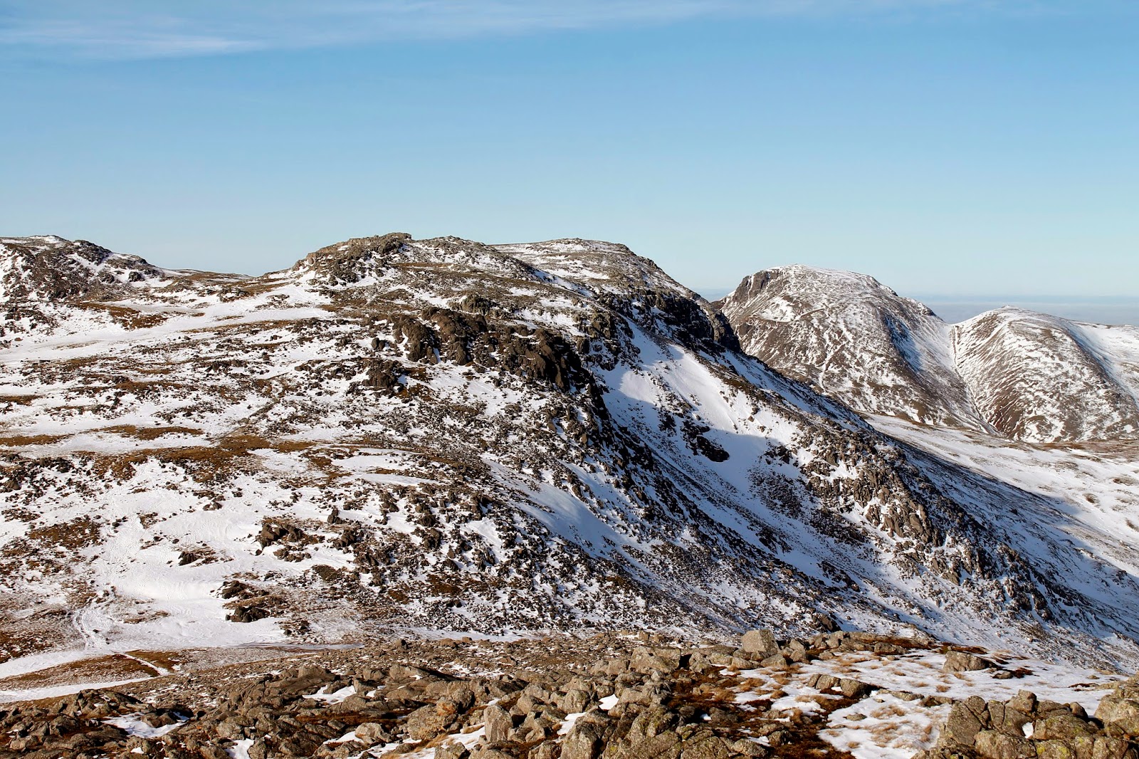
Esk Pike over Ore Gap
Pike de Bield
The crampons made for slow going over some fairly deep snow crossing from Ore Gap to Pike de Bield, so much so that I took them off again once I reached the peak. Again, there was no danger from a slip or fall here. I know Bowfell has a great view of the Scafells but I think Pike de Bield's is better. The same, generally, but much closer. The detail of the crags that litter the mountainside were all highlighted by the snow and sunshine, an epic spectacle. Add the inversion and I truly believe it's one of the best things I've ever seen. Honestly.
The mighty Scafells
Clouds crash against the Scafells
Scafell and Scafell Pike
Eskdale
Bowfell seen from Pike de Bield
Yeastrigg Crags leading down into Eskdale
I had a quick bite to eat before leaving Pike de Bield and returning to its parent peak, Esk Pike. It's an easy climb to the summit and, once again, another series of superb views. The last time I was on Esk Pike the weather was appalling so this more than made up for the return trip. The weather was still holding firm, a dazzling day on the fells if ever there was one.
The Langdale Pikes once again
Esk Pike's summit with the Scafells beyond
Great End, Great Gable and Green Gable over Esk Hause
A short distance from Esk Pike is Esk Hause, the highest of the Lakeland passes and the meeting point of four valleys; Borrowdale, Langstrath, Great Langdale and Eskdale. The famous shelter that sits just below the summit looked less than sheltering on this occasion, all four arms were covered in snow. I made my way swiftly up Allen Crags, the first new mountain of the day, as it stands only 50m or so higher than the shelter.
Allen Crags
The shelter below Esk Hause
Allen Crags presents a less than challenging climb
Allen Crags' summit
Great Gable, Aaron Slack and Green Gable
Allen Crags is the final peak on Glaramara's ridge and is often crossed by walkers heading in either direction though it rarely is an objective in itself. It does have a fine view of Great Gablegr though, which had decided to make an appearance during the early afternoon. After another short break, I descended to Angle Tarn, nestling in the shadow of Hanging Knotts, a vast crag that forms the northern wall of Bowfell.
High Raise
Langstrath
Rossett Pike
Angle Tarn
Hanging Knotts Gully - if you look closely there's a pair of climbers in there
As there was still a few hours of daylight left, I decided to include the loop across Rossett Pike and descend by the Stake Pass rather than calling it a day at Rossett Pass. The inversion was still in full force as well and I knew Rossett Pike would provide a grandstand view of Great Langdale. From Angle Tarn, Rossett Pike is as easy a climb as Allen Crags is, the summit is just a short distance from the main path. Just east of the summit is a small cairn that crowns Rossett Crag and it was here that I surveyed the immense blanket of cloud resting in the valley below.
The summit of Rossett Pike
Great Langdale and the small cairn on Rossett Pike
Cloud inversion in Great Langdale
Lingmoor Fell pokes out of the clouds
Glaramara
Ogling complete I proceeded northwards along the undulating ridge leading down from Rossett Pike to Langdale Combe, crossing the subsidiary tops of Buck Pike and Black Crags on the way. Langdale Combe is a fine example of post-glacial scenery; not only is it a hanging valley but it is filled with drumlins and moraines, relics of thousands of years of glaciation. Stake Pass, linking Langdale to Langstrath and Borrowdale, crosses Langdale Combe and I would be using it on my return leg back to the valley below.
The Pikes above the clouds
Looking across Buck Pike towards High Raise
Black Crags
The clouds lap against Mart Crag
Langdale Combe
The high fells eventually start to succumb to the cloud
I plunged into the intimidating wall of fog that was still lingering in the valley, noticing a distinct change in temperature as I did so. It was a real pea soup making it impossible to tell how far it was to the valley below. To some extent, this made the descent that much more straightforward as there are no reference points to show you how far to go or how far you've been, it was simply a case of keep going. The descent was certainly helped by the path which is very well laid and makes for speedy movement down the hillside.
Approaching the clouds
Inside the inversion
The last glimpse of sunshine
Eventually, though much quicker than I anticipated, I reached the valley bottom where the path joins the one descending from Rossett Pass. Here, the Cumbria Way leads right the way back to the campsite, though a couple of miles walk stood between me and the car. The Cumbria Way is a linear long-distance footpath passing through the towns of Coniston and Keswick. The 112km route through the heart of the Lake District links the two towns of Ulverston and Carlisle.
A small footbridge crosses Stake Gill
The Cumbria Way in Mickleden
Gloomy trees in Mickleden
I got a move on along the path, keenly aware that the afternoon was beginning to draw to a close and I was getting close to finishing time I'd left stuck in the car window. I certainly didn't want a diligent person calling out the MRT just because I was a few minutes late. I made it back just in time, thoroughly knackered after my adventure around Bowfell. This walk has easily gone straight in towards the top of my best walks, it might even be the very best so far. I'm not sure many days can top it.

No comments :

Post a Comment