Saturday 16 April 2016

The Coledale Round

Coledale Round 16-04-2016

This map was created using GPS Visualizer's do-it-yourself geographic utilities.

Please wait while the map data loads...


Route: Braithwaite, Kinn, Sleet How, Grisedale Pike, Hobcarton Crag, Hopegill Head, Sand Hill, Coledale Hause, Dove Crags, Grasmoor, Wandope Moss, Wandope, Crag Hill, Eel Crag, The Scar, Sail, Sail Pass, Scar Crags, Causey Pike, High Moss, Outerside, Stile End, Barrow, Braithwaite Lodge, Braithwaite

Date: 16/04/2016
From: Braithwaite


Parking: Foot of Whinlatter Pass
Start Point: Foot of Whinlatter Pass
Region: North Western Fells

Route length: 13.1 miles (21 km)
Time taken: 07:05
Average speed: 1.8 mph
Ascent: 1,649m
Descent: 1,678m

Wainwrights on this walk:
Grisedale Pike (791m), Hopegill Head (770m), Grasmoor (852m), Wandope (772m), Crag Hill (839m), Sail (773m), Scar Crags (672m), Causey Pike (637m), Outerside (568m), Barrow (455m)

Additional summits: Kinn (374m), Hobcarton Crag (739m), Sand Hill (756m), Eel Crag (807m), Stile End (447m)

Other points of interest: Hobcarton Crag, Coledale Hause, Dover Crags, Force Crag Mine

The longer days of summertime are finally upon us which means full days out in the mountains without the looming pressure of sunset to hurry you on your way. Longer days mean longer walks and today's, the Coledale Round, is amongst the longest of the well established days out. 13 miles and 5,000ft of elevation gain would see us across 15 peaks in one of the most picturesque areas of the Lake District. Throw in some superb early Spring weather and you have a real classic that's hard to beat.

Our starting point was a short distance from Braithwaite as the narrow road towards Whinlatter begins its climb up through the dark woods. An old quarry (I assume) with space for a few cars sits at the foot of a set of wooden steps that throw you straight into the action. These steps lead up onto the long sweeping southeastern ridge of Grisedale Pike.
The climb out from the car park
A bright morning over Skiddaw
After the initial stepped climb, the gradient subsides slightly as the route crosses the first peak of the day, the small summit of Kinn, a high point on the lower ridge before it really gets going on its way to Grisedale Pike. It was here that we came across a pair of bright gloves, evidently escaped from someone's pack earlier in the day. We picked them up in the hope of catching up with its owners, who were most likely heading in the same direction as us. Whether we would catch them was debatable, though.
Causey Pike across Coledale
The long ridge up to Grisedale Pike
Sail seen across the valley
Panorama from the climb up Grisedale Pike
Kinn with Skiddaw beyond
The path steepens as it climbs up to Grisedale Pike, a substantial peak with a truly mountainous profile - a real jewel in the crown of the Northern Fells. To add to its appeal, it has a tremendous view of the surrounding landscape, the most dramatic feature being the immense face of Hopegill Head. I had been disappointed to miss out on the view last time I was here thanks to low cloud but, thankfully, our luck was in today.
Climbing Grisedale Pike via Sleet How
Grisedale Gill and the trees of Whinlatter
A great view of the triangular profile of Grisedale Pike
Crag Hill seen across the valley
Grisedale Pike's summit
Panorama from Grisedale Pike
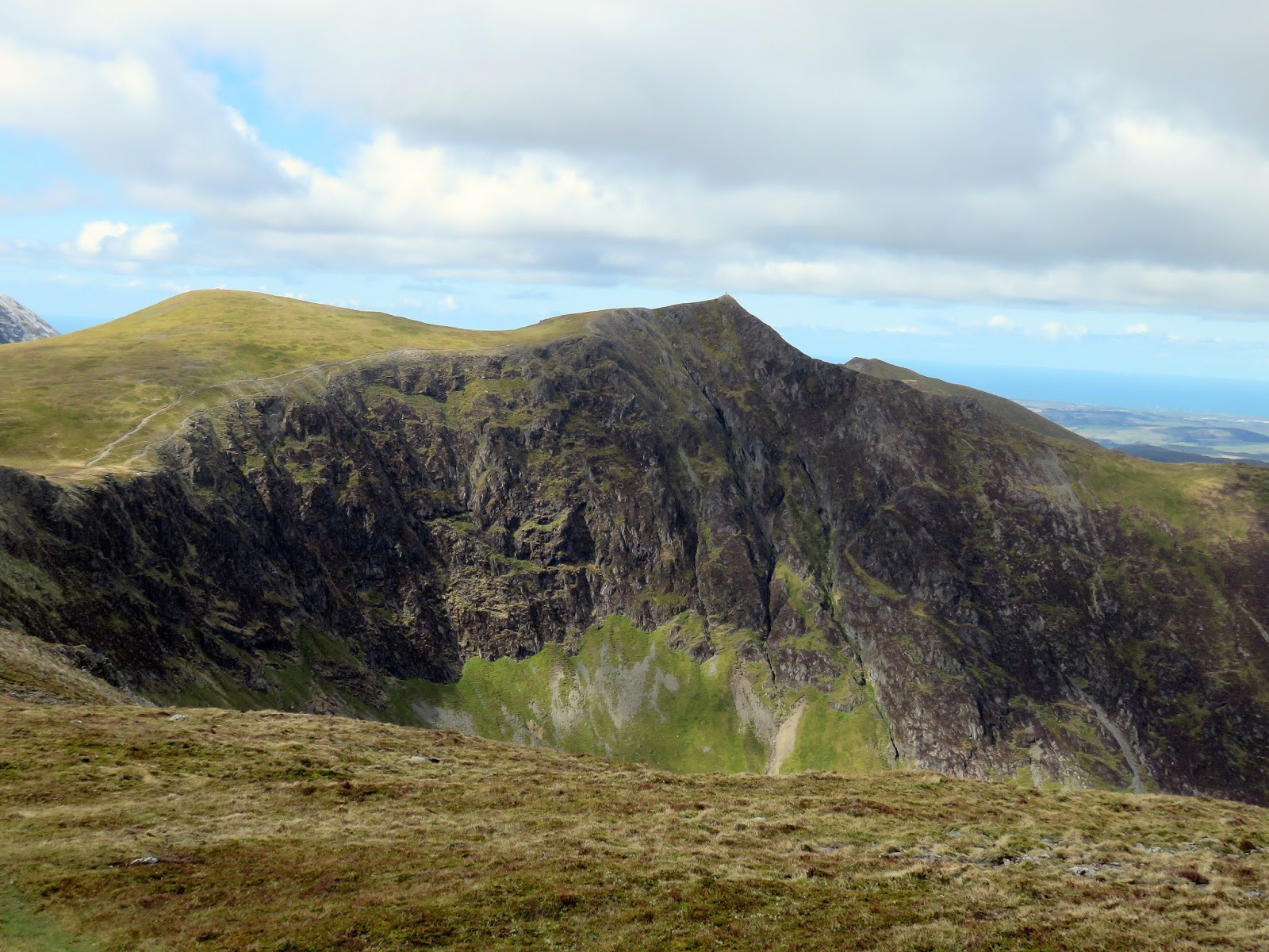
The magnificent Hopegill Head
The view along Hobcarton Crag to Grasmoor
The shapely peak of Hopegill Head is reached by crossing the top of Hobcarton Crag, a rim of crag that lines the head of Hobcarton with a subsidiary top of its own. Hobcarton Crag is home to a rare plant - the alpine catchfly. The only other place it can be found in the UK is atop a lonely mountain in Scotland.
Hopegill Head seen across Hobcarton Crag
Looking along Hobcarton Crag to Grisedale Pike
Hobcarton Crag
Hopegill Head itself forms the head of two valleys; that of Hobcarton (along with Hobcarton Crag) and that of Hope Beck (or Hope Gill). Both of these small mountain streams find their way to the River Cocker and out to sea at Workington. We left Hopegill Head, over Sand Hill and dropped down to Coledale Hause, the mountain pass that separates Coledale from Gasgale and provides a direct route between Loweswater and Keswick.
Hopegill Head's summit
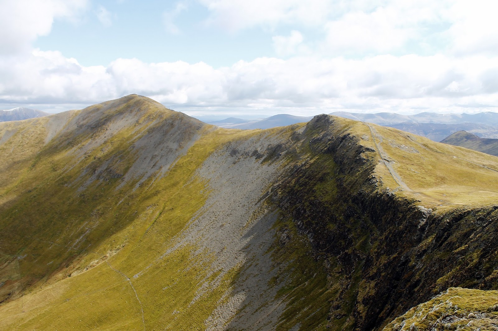
The view along the Whiteside ridge
Below the hause is the Force Crag Mine, an early lead mine prior to its use for extracting barites. During the Second World War, tons of barytes were extracted for making munitions. Trucks transported materials from the mine levels high above Force Crag down the fell side along what became known as the 'Burma Road'. The operation was very risky particularly during icy winters; as a result, an aerial ropeway was built, but this also failed in freezing conditions. Force Crag Mine was the last working metal mine in the Lake District, prior to its final abandonment in 1991. The National Trust now own the mine and open the processing mill on select days of the year.
Coledale Hause and the route up towards Grasmoor
Crag Hill standing over Coledale Hause
Coledale
Sand Hill from Coledale Hause
Whiteside in the sunshine
Grasmoor
From Coledale Hause, a small path leaves the main gravelled route and begins to climb Grasmoor. This path, though not as popular as the way up from Wandope Moss, clings to the edge of Dove Crags and provides a rare view down into the coombe below. Grasmoor's summit stands a few hundred metres out across a large grassy plateau and a cairn, further still, marks a fine view over Buttermere.
Looking west over Low Fell to Loweswater
Dove Crags on Grasmoor
The less impressive side of Hopegill Head
Grasmoor's summit shelter
We had hoped that we may come across the owner of the lost gloves having lunch on the summit but it was not to be. Any hope of reuniting them with their owner was lost. There was, however, a fateful turn when a couple turned up, one wearing just one glove. It so happens that she had lost hers and, given that we were unlikely to find the owner of the pair we found, they were donated to a needed cause - it was cold after all, despite the sunshine. Good deed done, we packed up lunch and continued on to the second half of the round.
The Scafells and Great Gable
High Stile and High Crag
Buttermere
Wandope was our next stop, a seemingly innocuous lump on the horizon but, standing on the summit, its plain to see why Wainwright included it in his books - it's another excellent viewpoint. The summit sits atop the striking feature of Addacomb Hole, a symmetrical hanging valley that resembles a half crater.
Wandope - not impressive from this side
Wandope's summit
The view from Wandope
The path from here hugs the edge of Addacomb Hole from where Wandope finally begins to resemble something like a mountain. It climbs up to the summit of Crag Hill (or Eel Crag if you're that way inclined) which is topped by the only trig pillar on the round. That said, the pillar is in a sorry state of repair having tumbled off its base; this wasn't the case a couple of years ago though it looked to be on its last legs then. A short excursion from Crag Hill leads to the subsidiary top of Eel Crag; another Birkett in the bag.
Crag Hill over Addacomb Hole
Addacomb Hole
Wandope
The tumbled trig pillar on Crag Hill
A large snow flurry drifts pass
Grisedale Pike, Coledale and the Force Crag
The high fells
Leaving the summit of Crag Hill
The round continues steeply down from Crag Hill along The Scar down into a depression before climbing up again to reach the summit of Sail. Once again, things have changed a little since I last visited - the cairn has moved from its moat to a dry patch just beside it. One thing that hasn't changed though is the zig-zag path that links Sail to Scar Crags - it is ugly and I'm tempted to say it looks worse than the previous line of erosion.
The small hause between Crag Hill and Sail
Knott Rigg and Sail Beck
Crag Hill
Sail's summit
Grisedale Pike over Coledale
Another large snow flurry
The ugly path to Sail Pass
Scar Crags is an impressive beast with steep slopes that descend on either side of the narrow ridge meaning it is very rarely climbed directly though remains a busy fell thanks to its position on the Coledale Round. It is best seen from afar however as the crags are difficult to see over the crest of the ridge. The northern slopes of Scar Crags, below Long Crag, contain the remains of the Lake District’s only cobalt mine. It was opened by the Keswick Mining Company in 1846. A road and an inclined tramway were built to convey the ore down to Stonycroft in the Newlands valley though the mine was not a success as it was impossible to extract the mineral from the ore in the expected quantities and it closed in due course.
View from Scar Crags to Causey Pike
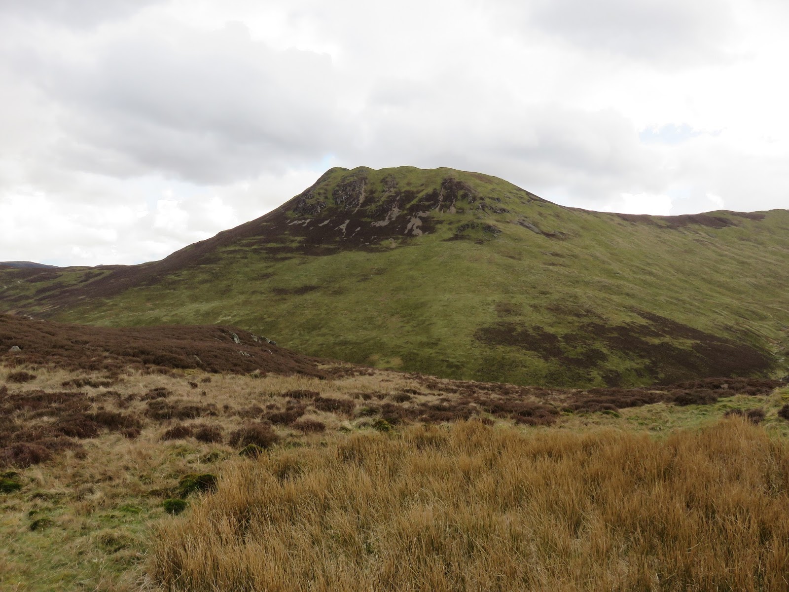
Outerside
Causey Pike
Newlands and Keskadale from Scar Crags
Marking the end of the ridge is the superb summit of Causey Pike with its grandstand view of Keswick and Skiddaw. What's more, a series of snow flurries were sweeping in over the Vale of Keswick making for an impressive scene. The showers continued as we made our way a short distance back along the ridge, following the path down into High Moss and the head of Stonycroft Gill. Ahead are the individual lumps of Outerside, Stile End and Barrow, a trio of fells that complete the route back to Braithwaite.
Ard Crags
Causey Pike's summit
Derwentwater and Keswick from Causey Pike


Scar Crags
A shower engulfs Dodd
Stonycroft Gill
The final peak on the round is little Barrow, itself having a fine view across Keswick and over Coledale to Grisedale Pike. All eyes were on the line of showers that were crossing Keswick - a truly stunning spectacle.
Force Crag mine
The summit of Outerside
Barrow and Derwentwater from Outerside
Causey Pike
Barrow marks the final hill of the day
Skiddaw picked out in the sun
Barrow's summit
An easy ridge falls down to Braithwaite Lodge and then Braithwaite itself before we passed through the village to the car. We were still accompanied by the impressive views across the Vale of Keswick and Skiddaw. Eventually, we were reunited with the car and were able to finally have a sit down after an epic day on the fells. It's fair to say that the Coledale Round is one of the best high-level routes and one that should be saved for a clear day.
Dodd in the showers once again
Keswick and Derwentwater
The ridge leading down from Barrow
Showers over Skiddaw
Keswick beneath the showers
Carl Side, Skiddaw and Skiddaw Little Man
Braithwaite Lodge

No comments :

Post a Comment